
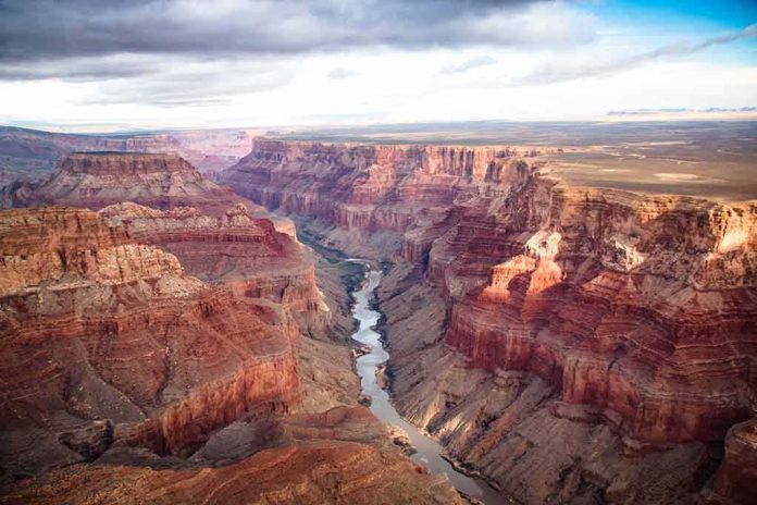
When a light aircraft goes down in the Grand Canyon’s remote North Rim, the story is first about terrain, time, and coordination: how the call comes in, how agencies marshal tools suited to wilderness and night, and how investigators then take months to separate what happened from why.
At a Glance
- Authorities located a missing Piper Comanche as wreckage and a debris field near the Basin area of Grand Canyon National Park’s North Rim; all three aboard were killed.
- The search spanned the late night into morning and used forward-looking infrared and night-vision from the air before ground teams found the site.
- The National Transportation Safety Board (NTSB) leads the accident investigation; the Park Service and FAA are supporting.
- Cause is not yet established; NTSB investigations progress from preliminary facts to a final probable cause over many months.
What Authorities Established: The Event, The Terrain, The Timeline
The National Park Service reported that the Grand Canyon Regional Communications Center received a missing-aircraft report late on a Sunday night; by approximately 10:15 a.m. Monday, searchers located an aircraft wreck and debris field near the Basin area on the park’s North Rim. There were no survivors. The aircraft was identified across official and contemporaneous reporting as a Piper Comanche carrying three people. Some outlets, citing initial agency inputs, placed the likely downing of the aircraft earlier in the evening, underscoring how nighttime events in remote terrain often yield a discovery time rather than a precise impact minute during the first day of response.
The recovery location matters operationally. The North Rim’s Basin country is austere, sparsely roaded, and backstopped by steep breaks and timber; search teams must fuse aviation assets with ground navigation and environmental risk management. Arizona Department of Public Safety aviation crews surveyed the area using forward-looking infrared (FLIR) and night-vision systems—sensors that can detect heat signatures or contrast changes against cold terrain—before National Park Service personnel pinpointed the wreckage by day. In conservation areas where rotor wash, rockfall, and visitor safety must be weighed alongside urgency, these methods are the standard of care.
How the Response Works: Roles, Tools, and Jurisdiction
Grand Canyon incidents trigger a multi-agency playbook refined over decades. The Park Service handles park communications, scene security, and immediate life-safety operations; state partners add aviation and specialized search capabilities; aviation regulators provide records and technical assistance. From the moment wreckage is found, the NTSB has the lead on determining what happened; the FAA assists within that process. That division of labor is not procedural trivia—it protects the integrity of the evidence chain and ensures the eventual analysis is driven by aviation specialists rather than field exigencies.
The initial public facts—aircraft type, occupant count, last known position, discovery time—are the durable backbone of day-one reporting. Names typically lag the event; agencies withhold them pending family notification and, in terrain like the North Rim, until recovery logistics are settled safely and respectfully. The absence of identities in the first 24–48 hours is not an information gap so much as a necessary pause while parallel tasks unfold: securing the site, mapping the debris field, and initiating the investigative handoff.
From Facts to Findings: What an NTSB Investigation Actually Does
The NTSB’s process begins with an on-scene factual build: investigators document the wreckage distribution, control positions, instrument indications, and evidence of pre-impact failures or fire; they recover any avionics data that may be stored, and they interview witnesses and first responders. A preliminary report follows quickly and is explicitly limited to these facts; it contains no analysis or probable cause. The analytical phase is where specialists knit together performance, human factors, maintenance history, meteorology, and terrain to produce a final report—often 12 to 24 months later—that states the probable cause and contributing factors.
Why that cadence matters here is straightforward. In general aviation accidents in mountainous or canyon terrain, causal strands are often intertwined: weather and light conditions that compress margins, pilot decision-making around route and altitude, mechanical reliability and maintenance records, and the unforgiving geometry of terrain that turns small deviations into non-recoverable profiles. The preliminary facts from Grand Canyon’s North Rim fix the “what” with confidence: a Piper Comanche, three aboard, wreckage located in the Basin area, no survivors. The “why” awaits the investigative sequence designed to answer it, not surmise.
🕯️ Grand Canyon plane crash
Went down ~7:15 p.m. Sunday, North Rim
Found Monday morning
3 killed, names not releasedCOMMENT 🕯️ for families#GrandCanyon pic.twitter.com/XwDHI3g8Pw
— RandomStuff A2Z (@RandomstuffA2Z) November 17, 2026
Why Canyon Airspace History Looms Large—And Why This Case Is Different
Any aviation incident at Grand Canyon evokes a long arc of safety reform born of tragedy. The 1956 mid-air collision between a TWA Super Constellation and a United DC-7 over the canyon, which killed 128 people, catalyzed the creation of the modern Federal Aviation Agency and a more rigorous national air traffic system. That history explains the public’s acute sensitivity to any aircraft loss near the park. It does not, however, map one-to-one onto a single-engine, non-airline accident in remote backcountry airspace; the institutional lessons and systems that grew from 1956 are the backdrop, not the blueprint, for what the NTSB will examine in a contemporary general aviation crash.
Operating Environment: Night, Mountains, and a Vintage Airframe
Piper Comanche models, while respected touring aircraft, are legacy designs; their safety profile, like any airframe, depends on maintenance currency, performance planning, and pilot proficiency. Night operations in mountainous terrain add workload—terrain awareness, oxygen considerations at altitude, and weather variability across canyon rims—all of which compress response time when something goes wrong. Investigators will pull logbooks, component histories, and any available avionics data, and they will reconstruct winds, ceilings, temperature, and moonlight to assess visual cues versus instrument dependencies. This is standard practice and often decisive in determining whether a failure, a decision chain, or both defined the final minutes.
What To Watch Next: Milestones That Actually Mean Something
Three near-term markers matter. First, the NTSB preliminary report: it will memorialize the factual scene record—aircraft identification, basic timeline, and observed damage—but will not assign cause. Second, public identification of the occupants by appropriate authorities, which enables clarity on qualifications, flight purpose, and ownership links through FAA records. Third, when the docket opens—photos, witness statements, meteorological packages, and maintenance records—the conversation can move from possibility to probability with evidence in hand. Until then, the established facts are firm and few: a Piper Comanche, three victims, a debris field on the North Rim’s Basin terrain, and a federal investigation now underway.
Sources:
azdailysun.com, themirror.com, azcentral.com, knau.org, abc15.com, yahoo.com, ntsb.gov