
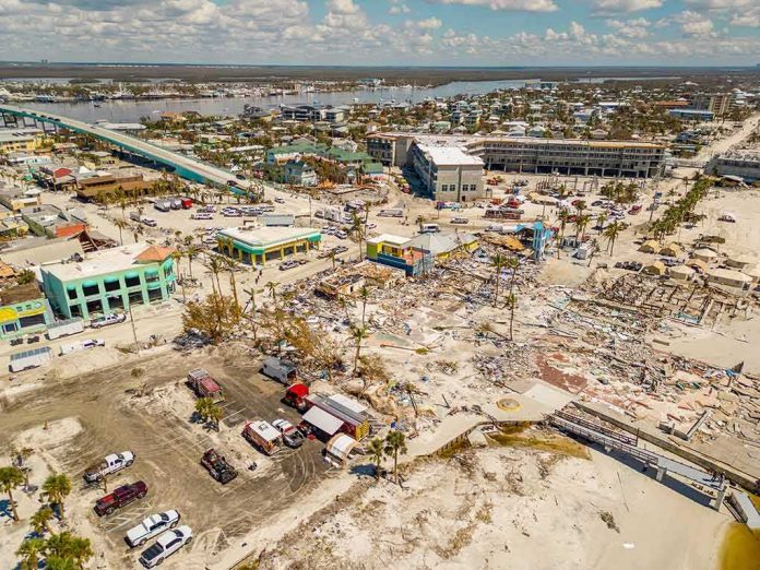
Nor’easters are not exotic outliers; they are the East Coast’s signature hazard, and when one organizes offshore with the right timing, bathymetry, and wind field, the combination produces exactly the kind of multi-day coastal flooding, damaging surf, and disruptive wind now forecast from the Mid-Atlantic into New England.
The Short Version
- Forecast guidance and National Weather Service discussions point to a slow-moving, strengthening nor’easter bringing strong onshore winds, heavy rain, and significant coastal flooding from the Carolinas to New England through the weekend.
- High-tide cycles will amplify impacts, with beach erosion, overwash, and pockets of moderate flooding where wind-driven surge stacks water into inlets and back bays.
- New England, including Rhode Island and eastern Massachusetts, faces the most persistent winds and surf as the low tracks north; coastal flood warnings and advisories are in effect.
- Expect marine hazards (gales to storms), travel delays, scattered power outages, and localized freshwater flooding where rain bands train over urban corridors.
What a nor’easter is and why this one matters
A nor’easter is a mid-latitude cyclone that intensifies along the East Coast as cold continental air meets warmer Atlantic air and waters. The defining feature is a strong northeasterly low-level jet—an onshore wind that piles water toward the coast, raises surf, and drives heavy precipitation bands inland. The mechanism is textbook baroclinic development: temperature gradients and upper-level divergence support a deepening surface low, while persistent fetch over the shelf amplifies waves and storm surge. This system checks those boxes and adds duration; the guidance favors a slow northward crawl and extended onshore flow, which is why official products highlight a “prolonged” period of hazardous coastal impacts, not a quick hit-and-run event.
Impacts map cleanly to that physics. Long-duration onshore winds mean repeated high-tide cycles with elevated water levels. Breaking waves atop the surge accelerate beach erosion and dune scarping, while back-bay flooding occurs when water forced through inlets cannot fully drain between tides. Where the pressure gradient tightens—coastal New Jersey through southern New England—gusts will down limbs in saturated soils and, with fully leafed trees this time of year, increase outage risk. Marine zones from the Delmarva to Cape Cod will see gale to storm-force conditions that make small-craft operations hazardous or impossible.
What the official guidance shows
National Weather Service forecast discussions and briefings are unambiguous about coastal hazards. The Boston office details coastal flood headlines for Massachusetts and Rhode Island, citing minor flooding with pockets of moderate flooding and prolonged beach erosion as onshore winds and astronomical tides coincide. Farther south, the Philadelphia/Mount Holly briefing package outlines a suite of warnings: High Wind Warnings for Atlantic coastal New Jersey and Delaware, Storm Warnings over adjacent marine zones, Gale Warnings for Delaware Bay, and coastal flood hazards extended through Saturday night—language reserved for impactful events, not routine wind-driven chop.
Regional analyses from major outlets mirror the agency signal: an early-season nor’easter will deliver coastal flooding, high surf, strong winds, and rain from the Carolinas to New England across a multi-day window. Coverage consistently highlights New England—especially Rhode Island and eastern Massachusetts—as a corridor for the strongest winds and heaviest rain as the low lifts north and tightens the gradient near the Gulf of Maine. The Washington Post’s weather team places the maturing low roughly a couple hundred miles east of Cape Hatteras as it gathers strength before tracking poleward, a classic waypoint for events that later focus on southern New England’s exposed capes and islands.
Track, timing, and tide: how impacts vary by place
Along the Outer Banks and Tidewater Virginia, early rounds of coastal flooding and overwash are the product of long fetch across the shelf and shallow estuaries that respond quickly to wind stress; even as the center tracks north, water can remain bottle-necked in back bays until the gradient relaxes. The Mid-Atlantic barrier islands—Long Beach Island to Atlantic City—are vulnerable to dune cuts where wave runup exceeds recent nourishment gains. Flood-prone back bays and tidal rivers, including the Delaware and Raritan, can experience moderate inundation when high tide coincides with peak onshore winds.
From Long Island through Narragansett Bay and Cape Cod, orientation and bathymetry magnify risk. Northeasterly winds align with the axis of these semi-enclosed waters, funneling surge into coves and harbor fronts. Repeated high-tide cycles across the weekend compound erosion and nuisance-to-moderate inundation, while outer coasts absorb the brunt of 6–12+ foot breakers on top of elevated water. Rainfall totals of 2–6 inches in narrow swaths are plausible where bands pivot, raising urban and small-stream flooding concerns; guidance clusters the heaviest rain and strongest winds Friday night through Saturday night across Rhode Island, central and eastern Massachusetts, Long Island, and the southern Maine coast.
Wind, rain, and marine hazards: practical expectations
The wind profile matters as much as peak gusts. A persistent 30–40 mph onshore wind with higher gusts mechanically raises water levels, even without an exceptional central pressure. That same persistence saturates soils, reduces tree anchoring, and makes otherwise routine gusts more consequential for outages. Marine interests should plan around gale to storm conditions on the Atlantic coastal waters, with steep, confused seas and hazardous inlets during ebb tides; Storm Warnings and Gale Warnings are already posted for broad swaths of the shelf waters and bays. On land, expect reduced speed limits on bridges, sporadic lane closures where surf overwashes cause debris, and mass-transit delays where coastal rail lines hug vulnerable embankments.
Rainfall is secondary to coastal surge in this setup but remains disruptive. Training bands can overwhelm urban drainage for brief windows, especially if high tide backs up outfalls. Where convergence zones stall—often near the north and west flanks of the low—localized 4–6 inch totals can produce basement and underpass flooding. Forecasters along the I-95 corridor note below-normal temperatures, breezy to windy conditions, and intermittent rain persisting through the weekend as the sprawling cyclonic envelope brushes the coast.
Why warnings sometimes sound louder than what you see
There is a structural reason coastal warnings can feel more urgent than the weather outside your window at issuance time: tide timing and local geography are destiny. The same synoptic storm produces very different local outcomes depending on inlet orientation, dune continuity, and whether the most onshore hours align with astronomical high tide. Emergency briefings and straightforward coastal-flood messaging exist to bridge that uncertainty window; they are designed to trigger protective actions—moving vehicles from flood-prone lots, securing boats, avoiding ocean jetties—before water arrives, not after.
The current forecast suite reflects that philosophy. Offices up and down the coast have issued layered headlines—coastal flood warnings and advisories, high wind warnings, marine gales and storms—because the risk is driven by compounding factors across multiple cycles rather than a single dramatic landfall. That is how responsible coastal-risk communication is supposed to work: warn for the plausible high-impact envelope and refine as the track, tide, and wind maxima come into sharper focus.
Weekend coastal storm update…
We are still about 72 hours from the potential start of a coastal storm (nor'easter) influence either here locally or somewhere in the NE US, and we STILL have no definitive clarity on the track and potential local impacts, if any. Ensembles are… pic.twitter.com/ZsTYW0gt1k
— Bobby Martrich | EPAWA (@epawawx) September 23, 2026
What to watch next
Two elements will determine the ceiling on impact. First, the storm’s forward speed and exact offshore track: a slower, slightly closer pass prolongs onshore flow into New England and keeps water stacked in back bays from New Jersey northward; a faster, wider track trims wind duration and limits the worst flooding to the most exposed capes and islands. Second, tide phasing: if the strongest winds coincide with the weekend’s higher astronomical tides, pockets of moderate flooding become more widespread; if they miss by a tide or two, impacts remain notable but more localized. Given the current guidance, coastal communities from coastal New Jersey to Downeast Maine should plan for repeated high-tide stress, significant beach erosion, hazardous surf, and scattered power disruptions into early next week.
Sources:
yahoo.com, forecast.weather.gov, weather.com, usatoday.com