
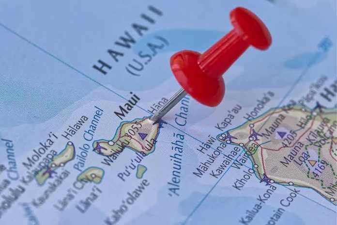
When a slow-moving cyclone taps deep tropical moisture over steep volcanic terrain, rainfall — not wind — becomes the defining hazard; that is precisely why Nolo’s approach to Hawaii and Polo’s surf-and-rain impacts in southwest Mexico matter now and on any future weekend with the same setup.
At a Glance
- NHC advisories placed Nolo near the Big Island with a Hurricane Watch and Tropical Storm Warning for Hawaii County, flagging life-threatening flood potential.
- Forecast rainfall for eastern and southern Hawaii Island: 15–30 inches with isolated peaks near 35 inches, a profile that drives flash flooding and mudslides on windward slopes.
- Nolo was near hurricane strength and projected to intensify to a major hurricane over the weekend, with track guidance keeping it close enough for severe rain impacts.
- In the eastern Pacific, Hurricane Polo produced heavy rain and dangerous surf along parts of Mexico’s southwest coast as NHC messaging shifted watches and warnings with the storm’s evolution.
Nolo’s risk profile: why the rain signal is so strong
Official guidance left little ambiguity about the hazard: Hawaii County was under a Hurricane Watch and a Tropical Storm Warning as Nolo edged north-northeast before a expected westward turn, a track geometry that maximizes rain on the Big Island’s windward flanks. The National Hurricane Center (NHC) and NOAA satellite analysts called out extraordinary rainfall potential — 15 to 30 inches with localized maxima up to 35 inches for eastern and southern portions of Hawaii Island — and warned explicitly of catastrophic, life-threatening flash flooding this weekend. In orographic regimes like Mauna Loa and Mauna Kea’s windward slopes, sustained upslope flow wrings additional moisture out of the circulation; that physics is why multi-foot rain totals are plausible in guidance and why debris flows, culvert blockages, and road washouts often outpace wind damage in Hawaiian cyclones.
Intensity and structure matter for where the heaviest rain sets up. Nolo’s sustained winds were already near hurricane threshold, with the NHC forecasting additional strengthening and a transition to a major hurricane over the weekend. A stronger, more symmetric core can consolidate rain bands, but the slow motion and moisture fetch are the higher-order controls on flooding here. The advisory’s center position near 16°N, 155–156°W and a crawl to the north-northeast at roughly 5 mph — followed by a turn — keeps the moisture plume pinned close to the island long enough to accumulate double-digit totals, especially along the Hāmākua and Puna districts and south into Kaʻū.
Watches, warnings, and what they really communicate
Confusion about “watch” versus “warning” routinely muddies public perception of storm risk. A Hurricane Watch indicates hurricane conditions are possible — not guaranteed — typically within 48 hours of the anticipated onset of tropical-storm-force winds that make last-minute preparation unsafe. A Tropical Storm Warning indicates those winds are expected in the specified area, guiding near-term protective actions and timing. For Nolo, the combination of a Hurricane Watch and a Tropical Storm Warning told a clear story: impactful winds likely, hurricane-force winds possible, and, crucially, a high-confidence, high-end rainfall threat even if the center jogs offshore. Expert users read that pairing as a cue to finish outdoor prep, secure drainage, and plan for rapid-onset flash flooding that can cut access roads before the strongest winds arrive.
That same communications framework governed Polo in the eastern Pacific. As the storm tracked offshore of southwest Mexico, NHC messaging highlighted heavy rainfall along the coast and shifted coastal watches and warnings as the wind field and closest approach evolved. At points, advisories carried Tropical Storm Watches and Warnings for portions of the coast; at later times, the center’s distance reduced immediate wind hazards even as dangerous surf and rain persisted, which is why an advisory could simultaneously state “no coastal watches or warnings in effect” while still emphasizing hazardous conditions for mariners and beach communities. Risk is dynamic; the watch/warning map is a snapshot, not the full hazard ledger.
Track and intensity: how close is close enough for severe impacts?
For Hawaii, “near miss” is a misleading phrase. The island’s topography and Nolo’s slow drift mean a center passing tens of miles offshore can still deliver the event’s worst practical outcome: multi-day, orographically enhanced rains with embedded, training convective bands. NHC’s advisory track and motion details — center near 16.0°N, 155.5°W moving about 5 mph with a forecast westward bend — maintain a long fetch of onshore flow across the Big Island’s windward side. In this regime, the Integrated Water Vapor Transport (IVT) corridor — the firehose of moisture — matters more than the precise inner-core landfall point. That is why the rainfall maxima in the official forecast sit over terrain, not over the predicted centerline.
On intensity, two truths can coexist without contradiction: labels can change rapidly across advisories, and the hazard to people and infrastructure often decouples from the category. The advisory set showed Nolo flirting with hurricane strength in the mid-80 mph range with higher gusts, then flagged a likely step-up to major hurricane over the subsequent 48–72 hours. For rainfall-driven disasters, the added wind matters for treefall and power, but the forcing that tips communities into crisis is duration plus moisture flux. Hawaii’s experience with systems such as Lane (2018) and others underscores that a slower, moisture-rich cyclone can produce catastrophic flooding even as the center remains offshore.
Polo near Mexico: heavy rain and surf without a clean landfall narrative
Polo’s hazard envelope looked different but no less serious for coastal communities. The NHC’s key messages cited heavy rainfall along portions of southwest Mexico, and earlier advisories triggered Tropical Storm Watches and Warnings where wind and surge risks edged into the expected range. As the circulation crawled northwest offshore the mainland, the heaviest rain and surf reached beaches and low-lying neighborhoods; reporting anchored in NHC data described dangerous surf and flooding in places accustomed to Pacific swell but vulnerable during slow-moving majors. Landfall fixation misses the point: a large, powerful hurricane paralleling the coastline can drive days of high surf, rip currents, beach erosion, and episodic flooding with only transient changes in formal coastal alerts as the wind field breathes in and out.
This is also where the storm’s internal structure shows up in the real world. A tight core with a “pinwheel” eye concentrates the most extreme winds, but broad rain shields and outer bands can lash shorelines far from the center. Local emergency managers time opening and closing of shelters and beach closures to those bands and tides, not to categorical labels alone. When an advisory later shows “no coastal watches or warnings in effect,” it often reflects a narrower wind threshold at that moment, not an all clear for surf and rainfall hazards.
Residents on Hawaii’s Big Island are bracing for potentially life-threatening and catastrophic flooding from Hurricane Nolo, while Mexico is still under threat of Polo. https://t.co/1OrIoZ1VeE
— ABC30 Fresno (@ABC30) September 25, 2026
What to watch next: signals that separate a bad day from a disaster
For Hawaii, three indicators will determine whether Nolo’s threat realizes its catastrophic potential. First, the storm’s forward speed: anything under about 8–10 mph dramatically raises cumulative rainfall. Second, band orientation relative to terrain: a stalled feeder band into Hilo Bay or along Saddle Road is a red flag for flash flooding and debris flows. Third, antecedent soil saturation: if showers precondition the slopes, smaller bursts tip the balance. NHC advisories and NOAA satellite products already outline these ingredients; local rain gauge and stream gauge spikes will be the on-the-ground confirmation as the core approaches.
For Mexico’s Pacific coast under Polo’s influence, the playbook is different but familiar: rip current statements and surf advisories are life-and-death messaging for swimmers and small craft long after peak winds pass; rainfall timing against high tides drives urban flooding; and beach erosion can undercut infrastructure in ways that do not map neatly to hurricane category. Follow the NHC discussion text for hazard emphasis and your local civil protection bulletins for road, port, and school decisions tied to those evolving conditions.
Sources:
nhc.noaa.gov, star.nesdis.noaa.gov, reuters.com