
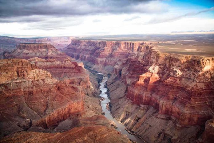
In the Grand Canyon, flash flooding turns minutes into margins; when Bright Angel Creek surged on August 29, 2026, it severed bridges, stranded hikers, and launched a fast, disciplined rescue that saved dozens even as authorities worked to account for more than a dozen people still unlocated.
At a Glance
- A significant flash flood hit Bright Angel Canyon and Phantom Ranch around 2:30 p.m. on August 29, 2026, destroying footbridges and washing out trails.
- Grand Canyon National Park evacuated at least 62 people; officials requested public help to identify those still unaccounted for, initially estimated at about 15–20.
- River traffic, Phantom Ranch, Bright Angel Campground, and the entire North Kaibab Trail were closed pending damage assessment and repair.
- National Weather Service warnings and the canyon’s topography explain the speed and severity of the flood surge through Bright Angel Creek.
What Happened: A Fast-Moving Flood Meets a Remote Corridor
By the time thunderstorms matured over the North Rim on August 29, the hydrology of Bright Angel Canyon had already set the trap. A cloudburst at altitude sends water racing along steep, slickrock-lined tributaries into Bright Angel Creek; in a matter of minutes, a manageable creek becomes a conveyor of boulders, debris, and sediment. The National Park Service logged the onset at approximately 2:30 p.m., with Phantom Ranch and the lower North Kaibab Trail squarely in the impact zone. Footbridges along the creek were destroyed or rendered impassable, trails sloughed off in sections, and debris pushed south into the Colorado River corridor. Air operations began quickly, lifting stranded hikers from the canyon floor as rangers secured high ground and closed routes into the flood-scoured corridor.
The casualty picture clarified more slowly, as it nearly always does in remote incidents. Within roughly 24 hours, the park reported 62 evacuees and appealed for information on anyone who might have been in Bright Angel Canyon, Phantom Ranch, or along the North Kaibab Trail during the storm. Simultaneously, multiple outlets—citing park officials—reported that about 15 people remained missing or unaccounted for as the search expanded by air and along the river. These two truths can coexist in the early phase: the hazard is indisputable, the headcount provisional.
Why This Corridor Is Vulnerable: Terrain, Hydrology, and Burn Scars
Bright Angel Canyon is a classic slot-to-tributary system feeding the mainstem Colorado. Its steep walls and narrow benches accelerate runoff; water cannot soak in fast enough, so it sheets, converges, and stacks energy where the topography funnels it. Add antecedent soil saturation from monsoon cycles and the hydraulic load spikes further. The National Weather Service flagged the risk explicitly, issuing a flash flood warning for the Bright Angel Creek basin tied to the Dragon Bravo fire scar—a reminder that post-fire soils repel water and shed flow rapidly, amplifying peak discharge and debris movement. The result is not a slow, predictable rise but a pulse: bridges can go from passable to gone in minutes. That is precisely what hikers and rangers reported on the ground.
Infrastructure compounds the stakes. Phantom Ranch sits at a confluence of footbridge networks, the North Kaibab Trail, utility corridors, and river access. When a surge takes out those crossing points, the canyon’s geometry limits detours: evacuations shift from foot to rotor, and search teams must sequence movements around unstable banks, rolling debris, and subsequent storm cells. The Park Service’s rapid closure of Phantom Ranch, Bright Angel Campground, the entire North Kaibab Trail, and river traffic in the affected segment reflects that operational reality.
Accounting for People: Why “Missing” Counts Move
In the first 48 hours of a canyon flood, the number the public wants—how many people are missing—is the hardest to fix with precision. Permits, campground manifests, and lodge rosters provide a starting point, but the canyon is porous: day hikers drop in from multiple trailheads, private trips alter itineraries on weather cues, and groups separate under stress. Park dispatchers cross-check radio logs, evacuation manifests, and witness accounts, then work outward through family notifications and tip lines to resolve duplicates and confirm safe-outs. That is why initial figures ranged from “more than 20” to “about 15” potentially unaccounted for, even as helicopter evacuations cleared dozens from the core impact area. As reconciliation progresses, the count typically tightens; the public appeal for information is a feature of that process, not a sign it is failing.
This pattern is not unique to the Grand Canyon. In remote-rescue operations—particularly those involving multiple approaches to a hazard area—authorities lead with the verified hazard and infrastructure impacts, then refine person counts as data converge. The Grand Canyon incident fits that model cleanly, from the confirmed flood start time and closures to the iterative, evidence-based updates on evacuations and unaccounted individuals.
Rescue and Response: What Worked When Minutes Mattered
The life-saving work in a canyon surge hinges on three elements: early hazard recognition, decisive movement to high ground, and rotor access windows. Ranger teams at Phantom Ranch executed that playbook. Witness accounts describe timely evacuation orders, controlled crossings while bridges still stood, and immediate staging for airlift as the creek rose. By the next morning, 62 people had been evacuated from Phantom Ranch and the lower North Kaibab corridor, a figure that aligns with the scale of helicopter operations visible from both rims and reported by the park. River operations were curtailed to keep the corridor clear for debris pulses and search flights, while ground teams began the slower task of probing washed banks and compromised trail sections.
Why does this cadence matter? Because flood rescues in the inner canyon are a race against changing conditions: another cell on the North Rim can reset the hydrograph in under an hour, grounding helicopters and cutting off foot access. Closing the North Kaibab Trail and the Phantom Ranch complex immediately is not merely bureaucratic caution; it preserves lanes for rescue and keeps additional visitors from entering a corridor still shedding debris and experiencing bank failures.
Grand Canyon flash floods wipe out bridges and 40% of the main water line; 15 missing, 2 confirmed dead as search and rescue battles extreme terrain and water shortages. Infrastructure collapse reshapes park life, stark reminder of nature’s force
https://t.co/gDfLYut9Dz— Azat TV (@azattelevision) September 1, 2026
What It Means Going Forward: Repairs, Water, and Visitor Access
Once the acute rescue window closes, attention shifts to infrastructure triage. Bridges over Bright Angel Creek are not decorative; they are the skeletal system of inner-canyon movement. Rebuilding safely requires geotechnical assessment of abutments, debris clearance, and sometimes full realignment where the channel has migrated. The same logic applies to the Trans-Canyon utilities that often parallel these routes—lines and supports exposed by scour must be inspected, shored, or replaced before visitor capacity can return to anything like normal. The park’s closures and advisories are therefore best understood as the operational guardrails of a complex rebuild, not an overreaction to a passing storm.
For visitors planning future trips, two practical implications follow. First, assume seasonal volatility. Monsoon dynamics make late-summer itineraries contingent: a noon forecast can invalidate a 2 p.m. plan. Build margin into trekking and river schedules, carry redundant navigation and communication tools, and treat every creek crossing as condition-dependent, not guaranteed. Second, respect closures as dynamic risk controls. When the Park Service calls for tips on unaccounted individuals or extends a trail closure after fair weather returns on the rim, it is operating on canyon time, not highway time—a rhythm set by hydrology, rock mechanics, and limited evacuation lanes.
Sources:
youtube.com, nps.gov, foxnews.com, apnews.com, forecast.weather.gov, azcentral.com