
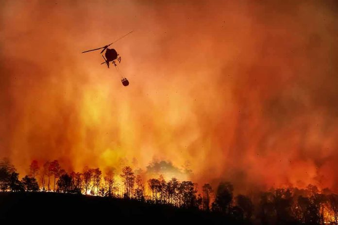
A fast‑moving Northern California wildfire has exploded into the state’s largest blaze of 2026, shutting highways and forcing families from their homes while officials race to catch up to the fire and to the data.
Story Snapshot
- The Biscar Fire in Lassen County is now California’s largest wildfire of 2026, at about 29,752 acres and roughly 5% containment.
- The fire started Friday northeast of Susanville, quickly jumped U.S. Highway 395, and triggered evacuation orders over roughly 300 square miles.
- Early public reports showed wildly different acreage and containment figures, revealing gaps and delays in official wildfire information.
- The blaze is burning in a sparsely populated high‑desert region, raising hard questions about how remote communities are prioritized when resources are stretched.
Biscar Fire Becomes California’s Biggest Blaze This Year
California’s Department of Forestry and Fire Protection says the Biscar Fire in Lassen County has grown into the largest wildfire in the state so far this year. On official incident pages and media briefings, state fire officials report the blaze at about 29,752 acres, with containment around five percent as of Sunday night. That size pushes it past the Santa Rosa Island Fire from May, which burned 18,379 acres and had been the largest fire of the 2026 season until now.
The Biscar Fire began on Friday near Snowstorm Road and Vincent Canyon, roughly twenty‑five miles northeast of Susanville. Local reports say crews first discovered flames shortly after 7 a.m., and by Saturday evening the fire had already scorched more than 3,000 acres with no containment. Over the following forty‑eight hours, strong winds and dry fuels helped the blaze race across high‑desert terrain, expanding more than tenfold and turning what started as a local incident into a statewide headline.
Highways Closed And Rural Residents Ordered To Flee
As the fire grew, county officials and state agencies moved to clear people out of its path and shut down key travel routes. The California Department of Transportation reports that U.S. Highway 395 is closed where flames crossed the roadway, cutting a major north–south link for drivers heading toward Reno or Lassen National Forest. Evacuation orders now cover both sides of Highway 395 from Ravendale southward, with extra warnings posted for surrounding areas and ranch lands as shifting winds threaten to push the fire toward scattered homes and barns.
Television and social media updates show maps shaded in red for mandatory evacuations and yellow for warnings, covering a wide swath of eastern Lassen County. Local stations describe deputies going door to door, urging residents to leave while smoke thickens and embers blow across the highway. For many of these families, the Biscar Fire confirms a fear they already had: that when a big blaze hits their remote community, help will be slow and confusing, and they will have to fend for themselves while larger cities get clearer information and more attention.
Confusing Numbers Expose Gaps In Fire Information Systems
As the fire spread, people trying to track it saw very different numbers depending on which website or tool they checked. One public lands wildfire tracker still lists the Biscar Fire at 12,338 acres and five percent containment, even after Cal Fire and regional news outlets updated the size to nearly 30,000 acres. Another independent mapping site shows the blaze stuck at 3,116 acres and zero containment, based on data from the first day of the incident. These older figures remained online even as local television stations began reporting the larger size and highway closures.
This mix of outdated and current data reflects a wider problem that frustrates both conservative and liberal communities: government and partner systems often do not sync quickly, leaving citizens to sort through conflicting numbers on their own. Fire experts note that early acreage estimates are often revised upward once aircraft and satellites can see the full perimeter, but ordinary people do not always hear that context. When you live near the flames, seeing three different official‑sounding numbers for the same fire can undermine trust in institutions and feed a sense that the system cares more about its paperwork than about clear, timely warnings.
Remote Region, Limited Resources, And A Growing Season Ahead
The Biscar Fire is burning in a remote, dry part of Northern California, with few large towns but many ranches, homesteads, and tribal lands. Independent wildfire analysts describe this zone as similar to the area burned by the 2012 Rush Fire, a huge blaze that spread over 315,000 acres of brush and grass with limited structures in its path. Because such regions have fewer voters and less property value on paper, large fires there can be treated as lower priority when aircraft, engines, and crews are scarce, even though they still threaten real lives and livelihoods.
Biscar Fire closes US Highway 395 northeast of Susanville, California https://t.co/ps4CDfWCnx
— RGJ.com (@rgj) July 20, 2026
Reports from The Lookout, an independent fire analysis channel, say aerial firefighting resources across the West are stretched thin. That strain forces incident commanders to compete for planes and helicopters and can delay a strong, coordinated attack on fast‑moving fires like Biscar. At the same time, national forecasters warn that a warmer, drier start to 2026 has set the stage for a more active fire season later in the year. For many Americans who already feel the government is slow, divided, or captured by “deep state” interests, a huge blaze in a rural county with mixed, confusing data looks like one more sign that basic public safety has fallen behind the real world.
Sources:
nypost.com, fire.ca.gov, mercurynews.com, nifc.gov, 2news.com, morethanjustparks.com, youtube.com, fresnobee.com